| 1. | Introduction | ||||||||||||
| 2. | The Project | ||||||||||||
| 3. | Pedagogical Objectives & Student Participation | ||||||||||||
|
|||||||||||||
| 4. | Assessment | ||||||||||||
| 5. | Concluding Comments | ||||||||||||
| 6. |
![]()
Using the Web to Explore
Historical Conflicts in Northern Ireland
Jay
D. Gatrell, Indiana
State University
Deborah Keirsey, Louisiana
State University
Abstract
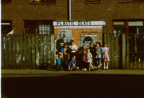
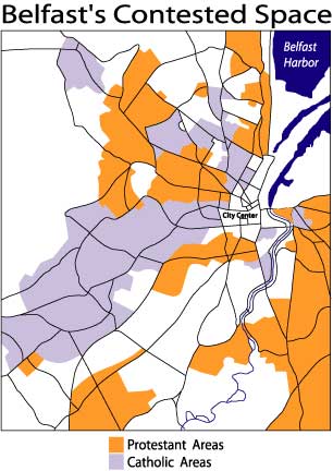
This paper documents a web project, entitled "People's
Art and Conflict in Everyday Space," that can be used to supplement
the traditional classroom experience, as well as to serve as a freestanding
educational site on the subject of violence in Northern Ireland. By focusing
on the controversial issues of peace and violence in Northern Ireland,
the project concretizes and gives voice to the many everyday struggles
and geographies that define the ongoing conflict. In the process, the
project not only informs but also provides students and instructors with
a range of inter-disciplinary tools necessary for a meaningful discussion
of the everyday realities and unique histories of both parties, Nationalists
and Loyalists. Currently, the website supplements a section of GEOG130
(formerly 330) World Geography at Indiana State University. Included on
the course homepage, it serves as a portal for student research and demonstrates
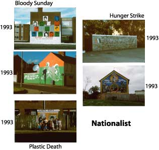
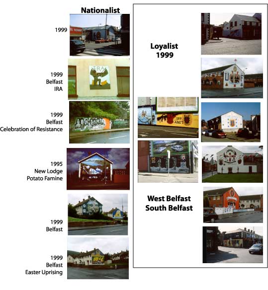
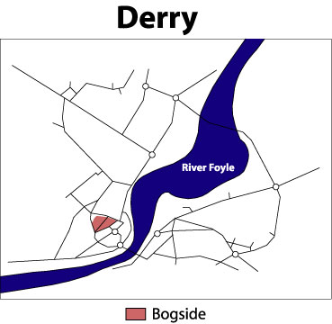
on-going conflicts in developed states. Currently, the content includes
descriptive text, related links, maps, images of murals, a brief white
paper, and a newly added message board.
![]()
![]() An external link to Peoples Art and Conflict in Everyday Space."
An external link to Peoples Art and Conflict in Everyday Space."
![]() An external link to GEOG130:World Geography.
An external link to GEOG130:World Geography.
![]() An external link to GeoNotes.
An external link to GeoNotes.